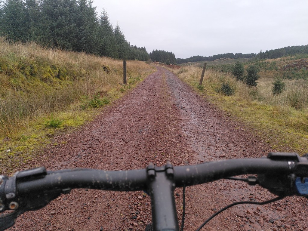
This is a great cycle with views over Glendaruel and Loch Fyne. It also takes you over the Otterferry hill road without having to go up the steep ascent at the start, the second half of it does have a lot of seemingly endless hills but I promise the downhills come.
Stats
Distance: 37.1km
Ascent: 904m
Offroad: 41%
Tyres: 4.5/5
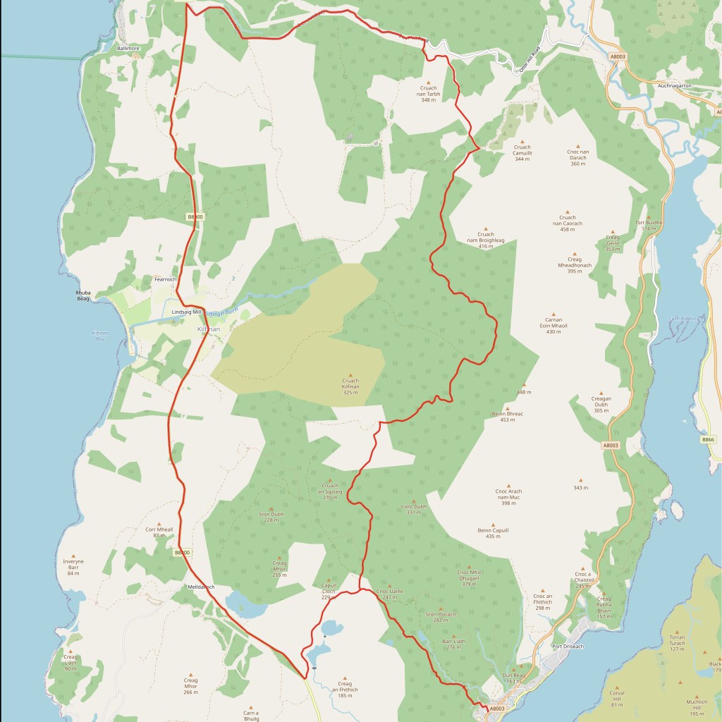
Directions
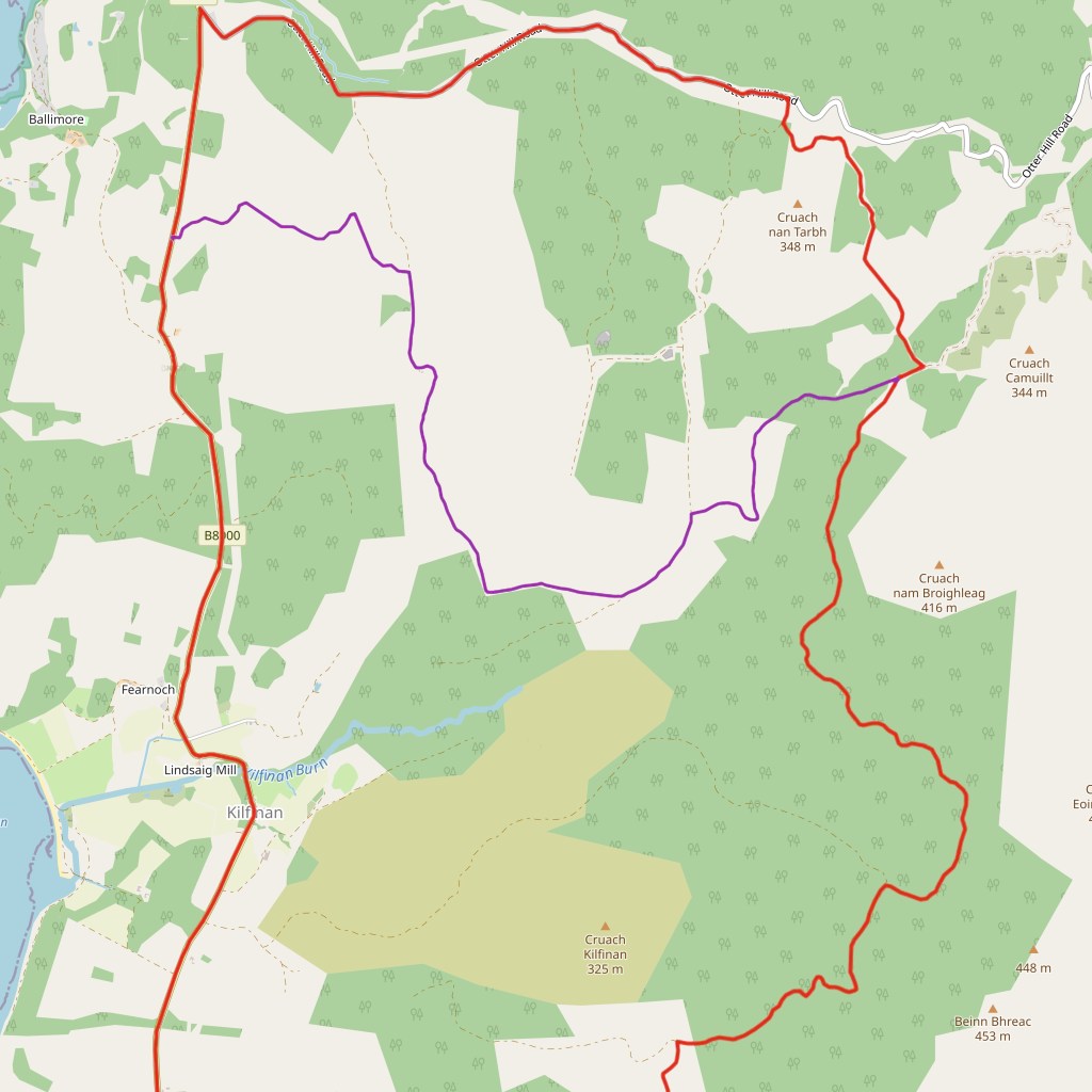
Follow the Kilfinnan loop until the bridge where you turn right. Continue on this track until the 3rd left. This comes out on the Otter Ferry hill road where you turn left down to another junction where you turn left again following the sign for Tighnabruaich. Stay on this road till you get to the powder dams turn off which you follow back down into Tighnabruaich.
Want to switch it up a bit? Here’s some detours:
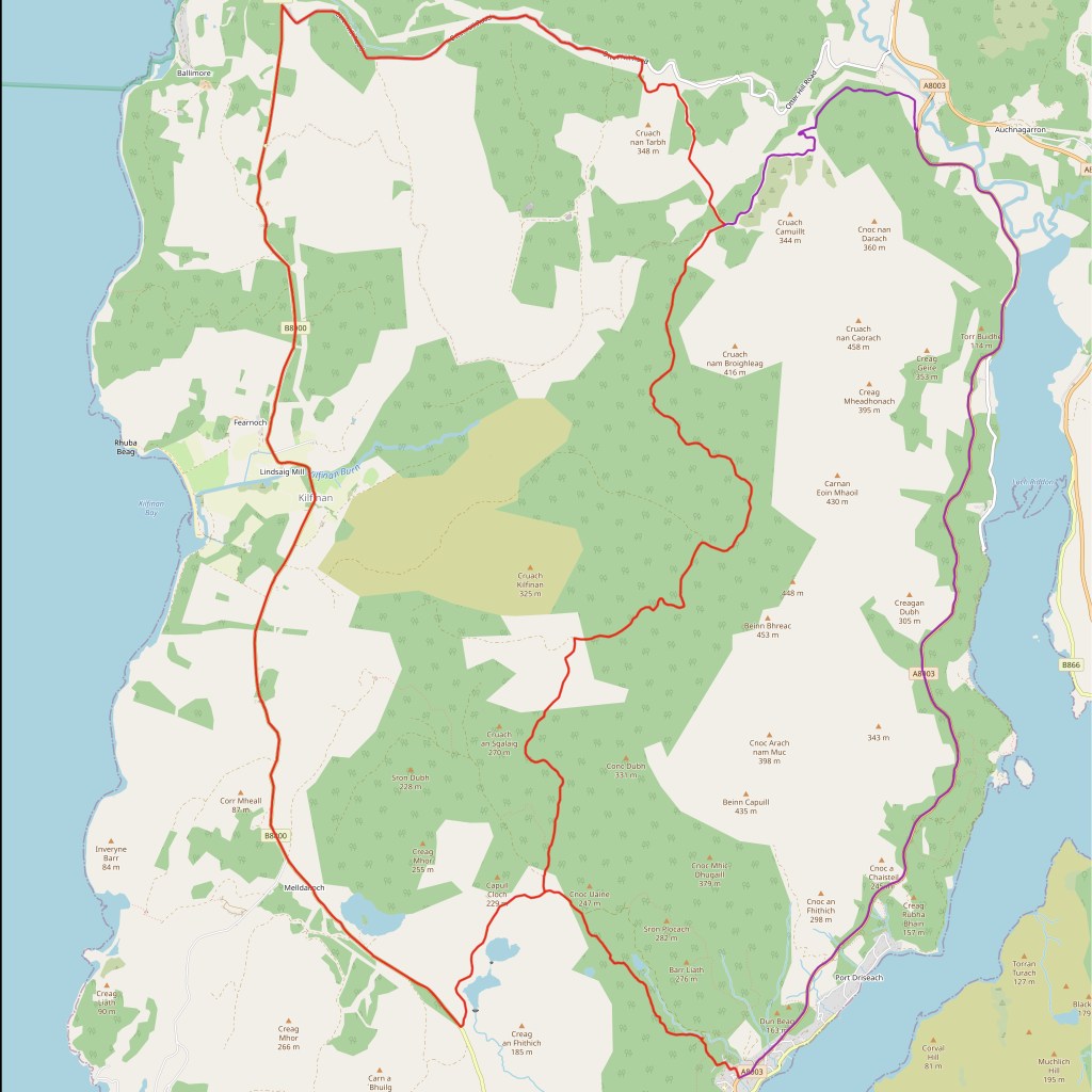
A non Otterferry loop
This way takes you back a much faster and easier way via the new road, however this doesn’t go anywhere near Otter Ferry and the new road can have some fast trucks on it so take care! This route also passes 2 geocaches, ‘Meckan’s Grave’ (GC12A56) and ‘Viewpoint’ (GC1CX60)
Stats
Distance: 7.9km (8.6km)
Ascent: 129m (176m)
Offroad: 100% (37%)
Tyres: 2/5 (2.5/5)
Directions
Instead of turning off at the third left, keep going straight. This will take down a twisting downhill and out onto the new road. Follow this right until reaching Tighnabruaich.
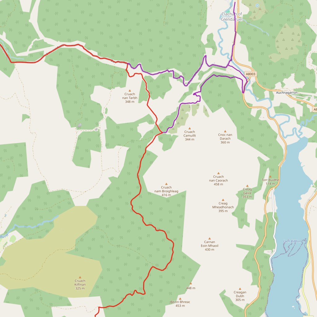
Adding in Glendaruel
This detour takes you down into Glendaruel to a great camping spot helping to break up the cycle. While it is possible to camp anywhere along the loop it’s mostly Sitka plantation which isn’t the best to camp in and this spot is right next to a river, and has space for hammocks and tents alike. It also passes through Glendaruel where you can see if you can find the Geocache ‘Good To Talk Glendaruel’ (GC1CPXH)
Stats
Distance: 11.8km (2.4km)
Ascent: 403m (88m)
Offroad: 30% (100%)
Tyres: 2/5 (1/5)
Directions
Follow A non Otter Ferry loop until joining the road where you turn left and then the left again along a track by the Ruel. Follow this over a bridge and you’ll come out onto a road. Turn right then left onto a bigger road, taking the first left off. Go down this road through Glendaruel taking the second left then a right onto a small track where you can camp. Re trace your tracks till the bridge, instead follow the road on and up the steepest hill you’ve ever climbed rejoining the original route.
An alternative way back
An alternative way back If you want to cut a bit of distance off the loop or even just want to explore some new tracks then this is for you. It goes past an abandoned farm which has some cool buildings. For a part of this, the tracks are more of a grassy walking path which are perfectly cyclable but a it slower especially in the wet.
Stats
Distance: 7.9km (8.2km)
Ascent: 129m (162)
Offroad: 100% (36%)
Tyres: 2.5/5 (3/5)
Directions
Instead of taking the third left after the bridge, take the second which is a hairpin turn. Stick left on this track not turning right onto a track which isn’t on the map. Turn left on the track you join, following it till a narrow track splits off on the left which you take. Turn left after the farm then left again when you join the road.
Click here to download a gpx file of the route, or Click here to download or view the route on an interactive map
Route updates
Otterferry loop – 09/09/25 – Tilhill are felling near the end and while the track isn’t closed at the moment, extra care should be taken and signs obeyed.

